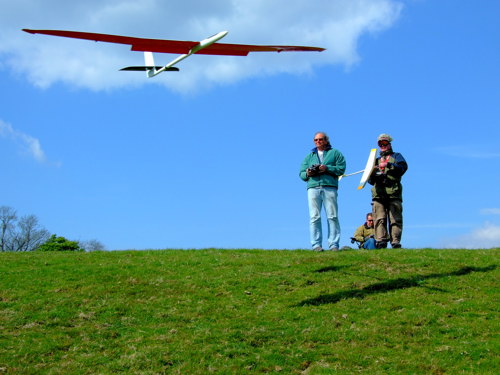
ARE YOU INTO SLOPE SOARING?
Do you like flying radio control gliders in the lift generated by hillsides and similar slopes?
If so, this website could be helpful. It is a guide to hills in England for soaring model gliders: what the slopes are like to fly at, what wind conditions they work in, how to find them ... it's all here.
Click on the alphabetical list of sites on the left to see the information. Or click on Wind Direction to see which slopes work in which winds.
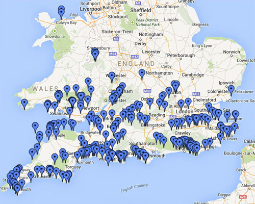
The information is also available in the form of a pdf document to make it easy to take with you. Plus there is a Google map showing not only the 80 flying sites featured on this website, but also 140 more flying sites right across England and Wales:
Click here to see the Slopehunter Google Map:
Click here to download the Slopehunter pdf:
Do you have an iPhone, iPad or Android device?
You should try Picasim, an excellent new slope soaring simulator:
If you are interested in the history of slope soaring sites
(Stone Age tombs etc), there is a short pdf here:
It might be worth checking out this new international
database of worldwide slope soaring sites:
![]()
![]()
..
"Gliders: to see them is to know that they can fly.
It is clear that they belong to the wind and the sky, and that they are
part of it as much as the clouds of a summer day."
Terence Horlsey, 'Soaring Flight', 1944